
Tornadoes can develop quickly, sometimes within minutes, which makes them one of the most challenging types of severe weather to forecast. Meteorologists cannot reliably predict the exact location and time of an individual tornado days in advance. Instead, they identify when the atmosphere is becoming favourable for tornadoes, forecast where the greatest risk may develop, and closely monitor thunderstorms for signs of rotation.
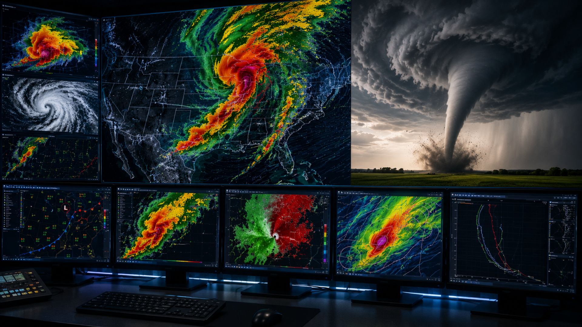
Modern tornado forecasting combines computer weather models, surface observations, weather balloons, satellites, Doppler radar, and reports from trained storm spotters. Together, these tools allow meteorologists to narrow a broad severe-weather threat into increasingly specific forecasts, watches, and eventually warnings when a tornado becomes imminent or is occurring.
Key Takeaways
- Meteorologists generally cannot predict the exact time and location of a tornado days in advance.
- Tornado forecasting begins by identifying atmospheric ingredients such as moisture, instability, lift, and wind shear.
- Computer forecast models can identify regions where severe thunderstorms and tornadoes may be possible several days ahead.
- Doppler radar becomes particularly important once thunderstorms develop because it can detect wind movement and rotation inside storms.
- Satellites, weather balloons, surface observations, and storm spotters provide additional information.
- Forecasts become increasingly specific as an event approaches and meteorologists receive more observational data.
- A tornado watch means conditions are favourable for tornadoes, while a tornado warning indicates a tornado is occurring or that there is an imminent threat.
Can Meteorologists Actually Predict Tornadoes?
Yes, but tornado prediction has significant limitations.
Meteorologists can often recognize that a particular region has an elevated risk of tornadoes well before thunderstorms begin. What they generally cannot do is say days beforehand that a tornado will touch down at a specific location at an exact time.
This is because predicting a tornado-favourable environment is different from predicting an individual tornado.
Large-scale atmospheric conditions can be measured and simulated with weather models. Meteorologists may therefore recognize that southern Ontario, for example, could experience an environment favourable for severe thunderstorms later in the day.
Determining which individual thunderstorm will produce a tornado—and exactly where that tornado will form—is much more difficult.
The forecast consequently becomes more precise as the event gets closer.
How Do Meteorologists Predict Tornadoes?
Meteorologists predict tornadoes through a process that starts with the large-scale atmosphere and gradually focuses on individual thunderstorms.
Several days before an event, forecasters examine computer models for patterns capable of producing severe weather. As the event approaches, observations from weather stations, weather balloons and satellites provide information about what the atmosphere is actually doing.
Once thunderstorms develop, meteorologists use Doppler radar and other observations to determine whether storms are strengthening or beginning to rotate.
The process can be thought of as progressively narrowing the forecast:
Favourable weather pattern → severe thunderstorm risk → tornado risk → rotating thunderstorm → possible or confirmed tornado
Each stage provides meteorologists with more information about the threat.
1. Meteorologists Look for the Ingredients Needed for Tornadoes
Before looking for an actual tornado, meteorologists determine whether the atmosphere contains the ingredients necessary for severe thunderstorms.
Four particularly important factors are moisture, instability, lift, and wind shear.
Moisture
Thunderstorms require moisture.
Warm, humid air near the surface can provide the moisture necessary to fuel powerful thunderstorms. Meteorologists examine measurements such as relative humidity and dew point to understand how much moisture is available.
A very moist lower atmosphere alone does not mean tornadoes will occur, but it can contribute to an environment capable of supporting intense thunderstorms.
Atmospheric Instability
Instability describes the atmosphere’s tendency to allow warm air near the surface to rise.
When warm, moist air exists beneath colder air higher in the atmosphere, parcels of air can become buoyant and accelerate upward. Strong instability can support the powerful updrafts associated with severe thunderstorms.
Meteorologists frequently evaluate Convective Available Potential Energy (CAPE) as one measure of the amount of energy potentially available to developing thunderstorms.
Again, high CAPE does not automatically mean tornadoes will form. Meteorologists must evaluate it alongside many other atmospheric variables.
Lift
Even an unstable atmosphere needs something to initiate rising motion.
Sources of lift can include:
- Cold fronts
- Warm fronts
- Low-pressure systems
- Drylines
- Outflow boundaries
- Terrain
When these features force warm, moist air upward, thunderstorms may begin developing.
Wind Shear
Wind shear is especially important when meteorologists assess tornado potential.
Wind shear is a change in wind speed and/or direction with height.
For example, winds near the surface might come from one direction while stronger winds several kilometres above the ground come from another.
Strong vertical wind shear can help thunderstorms organize and can contribute to rotation within a storm.
Meteorologists therefore examine not only how strong the winds are but how wind speed and direction change throughout different levels of the atmosphere.
2. Computer Models Identify Where Tornado Conditions Could Develop
Weather forecasting begins well before a thunderstorm appears on radar.
Numerical weather prediction models use mathematical equations to simulate the atmosphere. Meteorologists analyze these models to determine how temperature, pressure, humidity, winds, precipitation, and other atmospheric variables could evolve.
For tornado forecasting, forecasters may look for combinations of:
- Strong atmospheric instability
- Abundant low-level moisture
- Significant vertical wind shear
- Approaching fronts or low-pressure systems
- Strong upper-level winds
- Changing wind direction with height
- Conditions favourable for supercell thunderstorms
If several ingredients are expected to overlap geographically, meteorologists may identify the region as having an elevated severe-weather or tornado risk.
However, weather models aren’t simply “tornado predictors.”
They forecast the atmospheric environment. Meteorologists then interpret those forecasts to determine what kinds of thunderstorms could develop.
3. Weather Balloons Measure the Atmosphere Above the Ground
Surface conditions tell only part of the story.
Meteorologists also need to know what is happening thousands of metres above the ground.
One important source of this information is the weather balloon.
Weather balloons carry instruments known as radiosondes through the atmosphere. As the balloon rises, the instruments measure variables such as:
- Temperature
- Humidity
- Atmospheric pressure
- Wind speed
- Wind direction
These measurements create a vertical profile of the atmosphere.
That profile can help meteorologists determine how unstable the atmosphere is and how winds change with altitude—two important considerations when assessing severe thunderstorm and tornado potential.
4. Satellites Track Developing Thunderstorms
Weather satellites allow meteorologists to observe clouds and storms across enormous areas.
Satellite imagery can reveal where thunderstorms are developing, how quickly cloud tops are growing, and how storm systems are evolving.
Rapidly rising cloud tops can indicate powerful thunderstorm updrafts.
Satellite observations are particularly useful before storms enter radar coverage or across regions where ground-based observations are limited. They also provide meteorologists with a broad view of the weather system producing the severe-weather threat.
However, once a thunderstorm develops, another technology becomes especially important.
5. Doppler Radar Helps Detect Rotation
Doppler weather radar is one of the most important tools used to monitor thunderstorms capable of producing tornadoes.
Traditional radar information can show meteorologists where precipitation is located and how intense it is.
Doppler radar can provide additional information by measuring the motion of precipitation particles relative to the radar. This allows meteorologists to estimate wind movement within a thunderstorm.
When winds on one side of an area are moving toward the radar while winds immediately beside them are moving away, it can indicate rotation.
Meteorologists pay particularly close attention to strong, tightening rotation within severe thunderstorms.
What Is a Mesocyclone?
A mesocyclone is a rotating updraft within a thunderstorm.
Mesocyclones are commonly associated with supercell thunderstorms, a highly organized type of thunderstorm capable of producing destructive winds, large hail, and tornadoes.
Detecting a mesocyclone does not mean a tornado is necessarily occurring.
Many rotating thunderstorms never produce tornadoes.
Instead, the presence and evolution of rotation tell meteorologists that a storm may have the organization necessary to produce one. Forecasters can then monitor the storm more closely for additional evidence that the circulation is strengthening.
What Does a Tornado Look Like on Radar?
Radar generally isn’t showing meteorologists a photograph of a tornado.
Instead, forecasters look for radar signatures associated with tornadic thunderstorms.
Rotation
Velocity data can reveal strong rotation within the storm.
When winds moving toward the radar are located very close to winds moving away from it, meteorologists may identify a concentrated area of rotation sometimes referred to as a velocity couplet.
Tightening and strengthening rotation can increase concern that a tornado may be developing.
Hook Echo
Some supercell thunderstorms develop a distinctive radar shape known as a hook echo.
The hook can form as precipitation wraps around the rotating portion of a supercell.
Hook echoes have a strong historical association with tornadic supercells, but a hook-shaped radar signature by itself does not prove that a tornado exists.
Tornado Debris Signature
Modern dual-polarization radar provides meteorologists with additional information about the objects being detected by radar.
When a tornado is already on the ground and lofting debris, radar may sometimes detect characteristics consistent with debris being carried into the atmosphere.
A tornado debris signature can provide strong evidence that a tornado is occurring.
This is different from forecasting a tornado before it forms—the radar is detecting evidence associated with an ongoing tornado.
6. Meteorologists Track Supercell Thunderstorms
Not every thunderstorm receives the same level of attention.
Meteorologists become particularly concerned when a storm develops the characteristics of a supercell.
Supercells contain persistent rotating updrafts and can remain organized for long periods. They are responsible for many significant tornadoes.
Forecasters examine how a supercell changes over time, including:
- Strength of its updraft
- Location and intensity of rotation
- Changes in radar velocity
- Storm movement
- Precipitation structure
- Environmental wind shear
- Interactions with fronts and boundaries
The evolution of the storm matters just as much as any individual radar image.
A single radar scan is essentially a snapshot. A sequence of scans shows meteorologists whether the storm is becoming more or less dangerous.
7. Storm Spotters Provide Ground-Level Information
Technology isn’t the only source of tornado information.
Reports from trained storm spotters, emergency officials, law enforcement, researchers, and sometimes members of the public can provide valuable observations from the ground.
Spotters may report features such as:
- Rotating wall clouds
- Funnel clouds
- Tornadoes
- Large hail
- Damaging winds
- Storm damage
These reports can help meteorologists compare what radar indicates with what is actually happening at ground level.
This is particularly valuable because radar beams rise above the Earth’s surface as they travel farther from a radar station. At greater distances, the radar may be observing the storm well above ground level.
Ground observations therefore remain an important part of severe-weather monitoring.
Tornado Forecasts Become More Accurate as the Event Gets Closer
Tornado forecasting occurs across several different timescales.
Several Days Before
Meteorologists may recognize a large-scale weather pattern capable of supporting severe thunderstorms.
At this stage, uncertainty is relatively high. The forecast may identify a broad region where severe weather could eventually develop.
One or Two Days Before
Higher-resolution models and newer observations can help forecasters better determine where instability, moisture, wind shear, and lift are expected to overlap.
The geographic area of greatest concern may become clearer.
Hours Before
Meteorologists can compare forecasts with real observations.
They can see where fronts are actually located, how warm and humid the air has become, how the winds are behaving, and whether thunderstorms are beginning to develop.
A tornado watch may be issued when conditions become favourable for tornado-producing thunderstorms.
Minutes Before
Once thunderstorms exist, radar becomes critical.
Meteorologists monitor individual storms for strengthening rotation and other indications of tornado development.
If a tornado is occurring or there is an imminent threat, a tornado warning may be issued.
This is why tornado forecasting should not be thought of as a single prediction made at one point in time. It is a continuously updated process.
Tornado Watch vs. Tornado Warning
The distinction between a tornado watch and tornado warning is important.
| Alert | What It Generally Means |
|---|---|
| Tornado Watch | Atmospheric conditions are favourable for tornadoes and severe thunderstorms in or near the watch area. |
| Tornado Warning | A tornado threat is occurring or imminent and immediate protective action may be required. |
A simple way to remember the difference is:
Watch = conditions are favourable.
Warning = the threat is occurring or imminent.
Always follow the instructions provided by the official weather authority responsible for your location.
How Far in Advance Can Meteorologists Predict a Tornado?
There is no single amount of time that applies to every tornado.
Meteorologists can sometimes identify an elevated regional tornado risk days in advance, but that does not mean they know exactly where tornadoes will occur.
The prediction becomes increasingly localized as the event approaches.
Days beforehand, the forecast may essentially say that a broad region could experience severe thunderstorms capable of producing tornadoes.
Hours beforehand, meteorologists may identify a much smaller area where tornado-producing storms appear increasingly likely.
Minutes beforehand, radar and observations may provide evidence that an individual thunderstorm has developed dangerous rotation.
This distinction explains why someone might hear about a tornado threat days in advance while receiving an actual tornado warning only shortly before the tornado arrives.
Why Are Tornadoes So Difficult to Predict?
Tornadoes are difficult to predict partly because they occur on a much smaller scale than the weather systems that create the environments in which they form.
A low-pressure system can stretch across hundreds or thousands of kilometres. A tornado can be dramatically smaller.
Meteorologists therefore face two separate forecasting problems.
First, they must predict the large-scale atmospheric environment accurately.
Then they must determine how individual thunderstorms will behave within that environment.
Small differences in temperature, moisture, wind, storm interactions, and local boundaries can affect whether one thunderstorm produces a tornado while another nearby storm does not.
Even two seemingly similar supercells can have very different outcomes.
That is why favourable conditions should never be interpreted as a guarantee that a tornado will occur.
Can Meteorologists Predict Exactly Where a Tornado Will Touch Down?
Not reliably far in advance.
Meteorologists can forecast areas where tornadoes are more likely, but pinpointing an exact neighbourhood or street hours or days beforehand is generally beyond current forecasting capabilities.
Once a potentially tornadic thunderstorm develops, radar allows forecasters to track its movement and identify areas that could be threatened.
Warnings can therefore become geographically specific, but considerable uncertainty can remain.
This is one reason people should not wait to physically see a tornado before responding to an official warning.
Can Radar See a Tornado Forming?
Radar can detect conditions and storm-scale rotation associated with tornado development, but the situation is more complicated than simply seeing a funnel appear on a screen.
Meteorologists may observe rotation strengthening and becoming more concentrated. Dual-polarization radar may also identify debris after a tornado reaches the ground and begins lofting objects.
But radar has limitations.
The curvature of the Earth and the upward angle of radar beams mean that radar samples progressively higher portions of the atmosphere with increasing distance from the radar site. Terrain and other factors can also affect coverage.
Meteorologists therefore combine radar with other observations rather than relying on a single source of information.
Why Don’t All Rotating Thunderstorms Produce Tornadoes?
This is one of the central challenges of tornado forecasting.
A supercell can possess strong rotation without ever producing a tornado.
For a tornado to develop, rotation within the storm must ultimately become concentrated near the ground through a complicated series of interactions involving the storm and its surrounding environment.
Scientists continue to study precisely why some supercells become tornadic while apparently similar storms do not.
As a result, detecting a mesocyclone is an important warning sign—but it is not the same thing as detecting a tornado.
How Has Tornado Prediction Improved?
Tornado forecasting has benefited enormously from improvements in observational technology and computing.
Modern meteorologists have access to much more information than previous generations of forecasters, including:
- Doppler and dual-polarization radar
- High-resolution satellite imagery
- Faster computer models
- Denser weather-observation networks
- Automated weather stations
- Lightning detection networks
- Improved communications
- Mobile storm observations
- More powerful computing systems
Higher-resolution computer models can simulate thunderstorms in increasingly fine detail, while improvements in radar allow meteorologists to examine storm structure and wind movement more closely.
The ultimate goal is not necessarily to predict the precise path of every tornado days beforehand. It is to provide people with more accurate risk forecasts and as much useful warning time as possible.