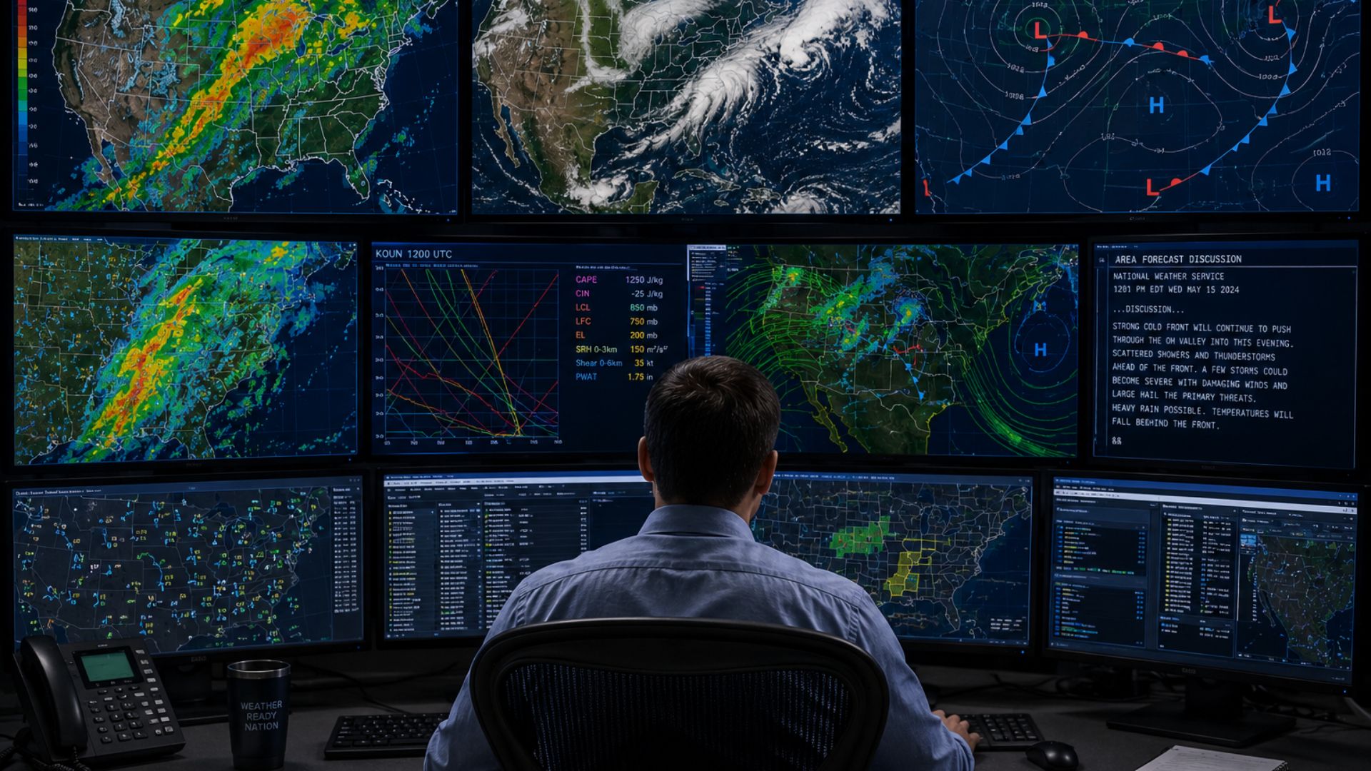

Meteorologists predict the weather by collecting observations of the atmosphere and using computer models to calculate how those conditions are likely to change. They analyze temperature, air pressure, humidity, wind, clouds, and precipitation using weather stations, satellites, radar, weather balloons, and other instruments.
These observations give meteorologists a picture of what the atmosphere is doing right now. Computer weather models then use that information to simulate what could happen over the next several hours or days. Meteorologists compare the models with real-world observations and use their expertise to produce the final forecast.
Weather prediction is therefore not based on one instrument, one computer model, or one meteorologist. It is a continuous process involving millions of observations and sophisticated forecasting systems.
How Does Weather Forecasting Work?
Every weather forecast begins with understanding the current state of the atmosphere.
Meteorologists need to know what is happening both at the Earth’s surface and high above it. Weather conditions thousands of kilometres away can eventually influence the weather experienced in a particular community.
Observations are collected continuously from across the world.
Meteorologists and computer models analyze measurements such as:
- Temperature
- Atmospheric pressure
- Humidity
- Wind speed and direction
- Cloud cover
- Precipitation
- Atmospheric moisture
- Conditions at different altitudes
These observations are fed into numerical weather prediction models.
The models use mathematical equations representing the behaviour of the atmosphere to calculate how conditions may evolve. Meteorologists then analyze the model guidance alongside current observations before producing a forecast.
What Tools Do Meteorologists Use to Predict the Weather?
Meteorologists have many different ways of observing the atmosphere.
Each forecasting tool provides a different piece of information, which is why multiple observing systems are used together.
Weather Stations
Surface weather stations are one of the foundations of weather forecasting.
They continuously measure conditions near the Earth’s surface and can provide observations of:
- Temperature
- Humidity
- Atmospheric pressure
- Wind speed
- Wind direction
- Precipitation
Thousands of observations collected across a region allow meteorologists to see how conditions differ from one location to another.
Changes in atmospheric pressure, for example, can help identify approaching weather systems. Temperature and humidity observations can show where different air masses meet, while wind measurements reveal how air is moving around areas of high and low pressure.
These measurements also allow meteorologists to determine whether forecasts made earlier are matching what is actually happening.
Weather Satellites
Weather satellites provide a much broader view of the atmosphere.
From space, satellites can monitor enormous weather systems spanning provinces, countries, oceans, and continents.
Satellite imagery can help meteorologists observe:
- Clouds
- Atmospheric moisture
- Storm development
- Tropical cyclones
- Wildfire smoke
- Snow and ice cover
- Movement of weather systems
Different satellite instruments can observe the atmosphere in different wavelengths, providing information that cannot always be seen with ordinary visible imagery.
Satellites are particularly valuable over oceans and remote areas where surface weather observations may be limited.
A storm approaching Canada, for example, can often be monitored by satellite long before it reaches a particular province.
How Does Weather Radar Help Predict the Weather?
Weather radar is particularly useful for monitoring precipitation that has already developed.
Radar sends pulses of energy into the atmosphere and measures the signals reflected back by precipitation particles.
This allows meteorologists to determine where precipitation is occurring and how it is moving.
Radar can help track:
- Rain
- Snow
- Thunderstorms
- Heavy precipitation
- Storm movement
- Precipitation intensity
Doppler weather radar can also measure movement toward or away from the radar, providing valuable information about winds within storms.
This makes radar especially important during rapidly changing weather.
While a computer model might predict thunderstorms during the afternoon, radar allows meteorologists to see where those storms actually develop and where they are moving.
How Do Weather Balloons Help Predict the Weather?
Surface observations only tell meteorologists what is happening near the ground.
Weather balloons help reveal what is happening higher in the atmosphere.
These balloons carry instruments called radiosondes, which measure conditions as they rise through the atmosphere.
Measurements can include:
- Temperature
- Humidity
- Atmospheric pressure
- Wind speed
- Wind direction
The resulting information creates a vertical profile of the atmosphere.
This is important because conditions above the surface can be dramatically different from those experienced on the ground.
For example, meteorologists forecasting snow need to know whether warmer layers of air exist above the surface. Severe-weather forecasters examine atmospheric instability and winds at different altitudes. Wind forecasts also depend on understanding how air is moving throughout the atmosphere.
Weather balloon observations are also incorporated into computer weather models.
What Are Weather Models?
Weather models are computer programs that simulate the atmosphere.
More formally, they are known as numerical weather prediction models.
The atmosphere follows physical laws governing the movement of air, energy, moisture, and other variables. Weather models use mathematical equations representing these processes to calculate how atmospheric conditions could change.
Because the atmosphere is enormous, a model cannot calculate conditions at every possible point.
Instead, it divides the atmosphere into a three-dimensional grid.
The model estimates conditions at points throughout that grid and repeatedly performs calculations to determine how those conditions will change over time.
The result is a computer-generated prediction of the future atmosphere.
What Can Weather Models Predict?
Weather models forecast far more than whether it will be sunny or rainy.
Depending on the model, meteorologists can examine predicted:
- Temperature
- Precipitation
- Snowfall
- Wind
- Humidity
- Atmospheric pressure
- Cloud cover
- Storm tracks
- Atmospheric instability
- Upper-level winds
Meteorologists can examine these variables at different times and altitudes.
This allows them to understand not only what the model predicts at the surface but also what may be happening throughout the atmosphere.
Why Do Meteorologists Use Multiple Weather Models?
There is no single weather model that perfectly predicts the atmosphere.
Different models can produce different forecasts.
One model might predict a winter storm travelling across southern Ontario, while another predicts the storm passing farther south.
Meteorologists compare these different possibilities.
If several independent models consistently predict similar conditions, confidence in the overall forecast may increase.
If the models strongly disagree, there may be greater uncertainty.
Forecasters also compare consecutive model runs. A storm that repeatedly appears in roughly the same location and at the same intensity can inspire more confidence than one whose predicted track changes significantly with every update.
What Is Ensemble Forecasting?
Meteorologists have another way of examining forecast uncertainty called ensemble forecasting.
Instead of running a weather model only once, an ensemble forecasting system runs the model multiple times with slightly different initial conditions or configurations.
Each simulation is called an ensemble member.
The members may produce slightly different outcomes.
Suppose meteorologists are tracking a storm expected several days from now. If nearly every ensemble member shows the storm passing through the same general region, confidence may be relatively high.
If the members show dramatically different storm tracks, uncertainty is greater.
Ensembles help meteorologists think about weather forecasts in terms of probabilities and possible outcomes rather than treating one computer simulation as guaranteed to happen.
How Do Meteorologists Predict Temperature?
Forecasting temperature involves understanding how much energy the Earth’s surface and atmosphere will gain or lose.
Meteorologists consider factors including:
- Incoming sunlight
- Cloud cover
- Wind direction
- Air masses
- Humidity
- Snow cover
- Time of year
- Terrain
- Proximity to large bodies of water
Wind direction can be particularly important.
If winds bring colder air from the north into a region, temperatures may fall. Winds transporting warmer air from the south can have the opposite effect.
Clouds also influence temperature. Thick clouds can reduce daytime heating while sometimes limiting how quickly heat escapes overnight.
Computer models simulate these processes to forecast temperatures throughout the day.
How Do Meteorologists Predict Rain and Snow?
Predicting precipitation requires meteorologists to determine whether enough moisture and lift will exist for precipitation to develop.
Meteorologists examine moisture throughout the atmosphere and identify features that could cause air to rise.
These might include:
- Low-pressure systems
- Cold fronts
- Warm fronts
- Atmospheric disturbances
- Mountains
- Convection
As moist air rises, it expands and cools. Water vapour can eventually condense to form clouds and precipitation.
Meteorologists then examine temperatures throughout the atmosphere to determine what type of precipitation could reach the ground.
That distinction is especially important during winter.
A temperature above freezing somewhere between the cloud and surface can affect whether precipitation arrives as snow, rain, freezing rain, or ice pellets.
How Do Meteorologists Predict Wind?
Wind is closely connected to differences in atmospheric pressure.
Air moves in response to pressure differences, while Earth’s rotation and friction influence its direction and speed.
Meteorologists examine high- and low-pressure systems and the spacing of pressure contours on weather maps.
A strong pressure difference over a relatively short distance can indicate the potential for stronger winds.
Weather stations provide surface wind measurements, while weather balloons and aircraft observations provide information about winds higher in the atmosphere.
Computer models then predict how these pressure patterns and winds may evolve.
How Do Meteorologists Predict Severe Weather?
Severe weather forecasting requires meteorologists to determine whether the atmosphere contains ingredients capable of producing hazardous conditions.
The exact ingredients depend on the hazard.
For thunderstorms, meteorologists may examine moisture, atmospheric instability, lift, and wind shear.
For blizzards, they consider snowfall, wind, visibility, temperature, and existing snow cover.
For hurricanes, meteorologists monitor ocean temperatures, atmospheric moisture, wind shear, storm structure, and large-scale steering patterns.
For flooding, forecasters may combine expected rainfall with river levels, soil moisture, snowmelt, and hydrologic models.
Specialized forecasting techniques are therefore used for different types of weather even though they all rely on the same broader observation and modelling network.
How Do Meteorologists Predict Weather Several Days Ahead?
Forecasting several days into the future depends heavily on numerical weather prediction.
Meteorologists first collect observations describing the current atmosphere.
Those observations are incorporated into computer models, which simulate how the atmosphere could evolve hour by hour.
The model might predict that a low-pressure system currently over the Pacific Ocean will move across western Canada, strengthen over the Prairies, and eventually bring precipitation to Ontario.
Meteorologists can track that predicted evolution several days before the system arrives.
However, uncertainty generally increases farther into the future.
A small difference in the storm’s development today can eventually produce a much larger difference several days later.
Why Do Weather Forecasts Change?
A changing forecast does not necessarily mean meteorologists made a mistake.
The atmosphere is constantly changing, and meteorologists never have a perfect measurement of every part of it.
Computer models begin with the best available estimate of current atmospheric conditions.
Small uncertainties in those starting conditions can grow as the forecast extends farther into the future.
New observations may also reveal that a weather system is developing slightly differently than earlier models predicted.
When new data becomes available, computer models are run again and meteorologists reassess the forecast.
The updated forecast may therefore show a different temperature, storm track, precipitation amount, or timing.
Why Is Weather So Difficult to Predict?
The atmosphere is an extremely complex system.
Everything is connected.
Changes in temperature influence pressure. Pressure differences influence wind. Wind transports heat and moisture. Moisture influences clouds and precipitation, which can then affect temperature and atmospheric circulation.
These interactions occur continuously across the entire planet.
Meteorologists also cannot measure every point in the atmosphere.
There are gaps between weather stations, radar sites, weather balloons, satellites, aircraft observations, and other instruments.
Computer models must estimate what is happening between observations.
This creates uncertainty that generally becomes larger the farther into the future a forecast extends.
How Accurate Are Weather Forecasts?
Forecast accuracy depends on the weather situation, location, forecast variable, and how far into the future the prediction extends.
Short-range forecasts generally benefit from a much clearer understanding of the current atmosphere.
As the forecast extends farther into the future, small uncertainties have more time to grow.
Some weather patterns are also more predictable than others.
A large, well-organized weather system may provide stronger forecasting signals than isolated summertime showers that develop over small areas.
This is why meteorologists often communicate probabilities and ranges rather than pretending there is complete certainty.
A forecast is best understood as the most likely outcome based on the information available at that time.
What Does Probability of Precipitation Mean?
One of the most familiar probabilities in a weather forecast is the probability of precipitation, often shown as a percentage.
It describes the probability of measurable precipitation occurring at a particular location during a specified forecast period.
It does not describe how long precipitation will last.
For example, a 70% probability of precipitation does not mean it will rain for 70% of the day.
The rain might last 20 minutes or several hours.
It also does not simply mean that 70% of the forecast region will receive rain.
Understanding the location and forecast period is important when interpreting precipitation probabilities.
Do Meteorologists Make the Forecast or Do Computers?
Both play an important role.
Computer models can process enormous amounts of atmospheric data and perform calculations that would be impossible for a person to complete manually.
But a model produces forecast guidance, not an infallible description of the future.
Meteorologists analyze that guidance alongside real-world observations.
They can identify model biases, compare different models, assess uncertainty, and recognize situations where a particular model may not be handling atmospheric conditions well.
Human expertise becomes especially important during unusual, rapidly changing, or high-impact weather.
The final forecast is therefore the result of both advanced technology and meteorological analysis.
How Is Weather Predicted in Canada?
In Canada, Environment and Climate Change Canada operates the country’s national weather forecasting and warning system.
Meteorologists use observations from weather stations, radar, satellites, weather balloons, lightning detection networks, ocean observations, aircraft, and other sources.
These observations are combined with numerical weather prediction models to produce forecasts covering communities across Canada.
Specialized meteorologists also monitor potentially dangerous conditions and issue watches and warnings when significant weather threatens an area.
Canada’s enormous geography makes this observing network particularly important. Forecasters need to monitor everything from Arctic weather systems and Pacific storms to Great Lakes snow squalls, Prairie thunderstorms, Atlantic hurricanes, and major winter storms.
How Has Weather Forecasting Improved?
Modern weather forecasting is dramatically more sophisticated than it was several decades ago.
Improvements have come from several areas at once.
Satellites provide increasingly detailed observations of the Earth and atmosphere. Radar technology allows meteorologists to examine storms more closely. Larger observation networks provide more measurements, while increasingly powerful computers allow weather models to perform more detailed calculations.
Forecast models themselves have also improved.
Higher-resolution models can represent smaller atmospheric features, while ensemble systems provide better information about uncertainty.
Artificial intelligence and machine learning are also becoming increasingly important parts of weather prediction, providing additional methods for producing and improving forecasts.
However, better technology does not eliminate uncertainty. Weather prediction remains a forecast of an evolving natural system rather than a guarantee of exactly what will happen.
The Bottom Line
Meteorologists predict the weather by first determining what the atmosphere is doing now and then calculating how those conditions are likely to change.
Weather stations measure conditions at the surface. Weather balloons measure the atmosphere above us. Satellites monitor weather systems from space, while radar tracks precipitation and storms. These observations are combined and fed into sophisticated computer weather models.
Meteorologists then compare multiple models, analyze real-world observations, evaluate uncertainty, and use their expertise to create the final forecast.
As new observations arrive, the process begins again.
That constant cycle of observing, modelling, analyzing, forecasting, and updating is how meteorologists turn atmospheric data into the weather forecast you see each day.