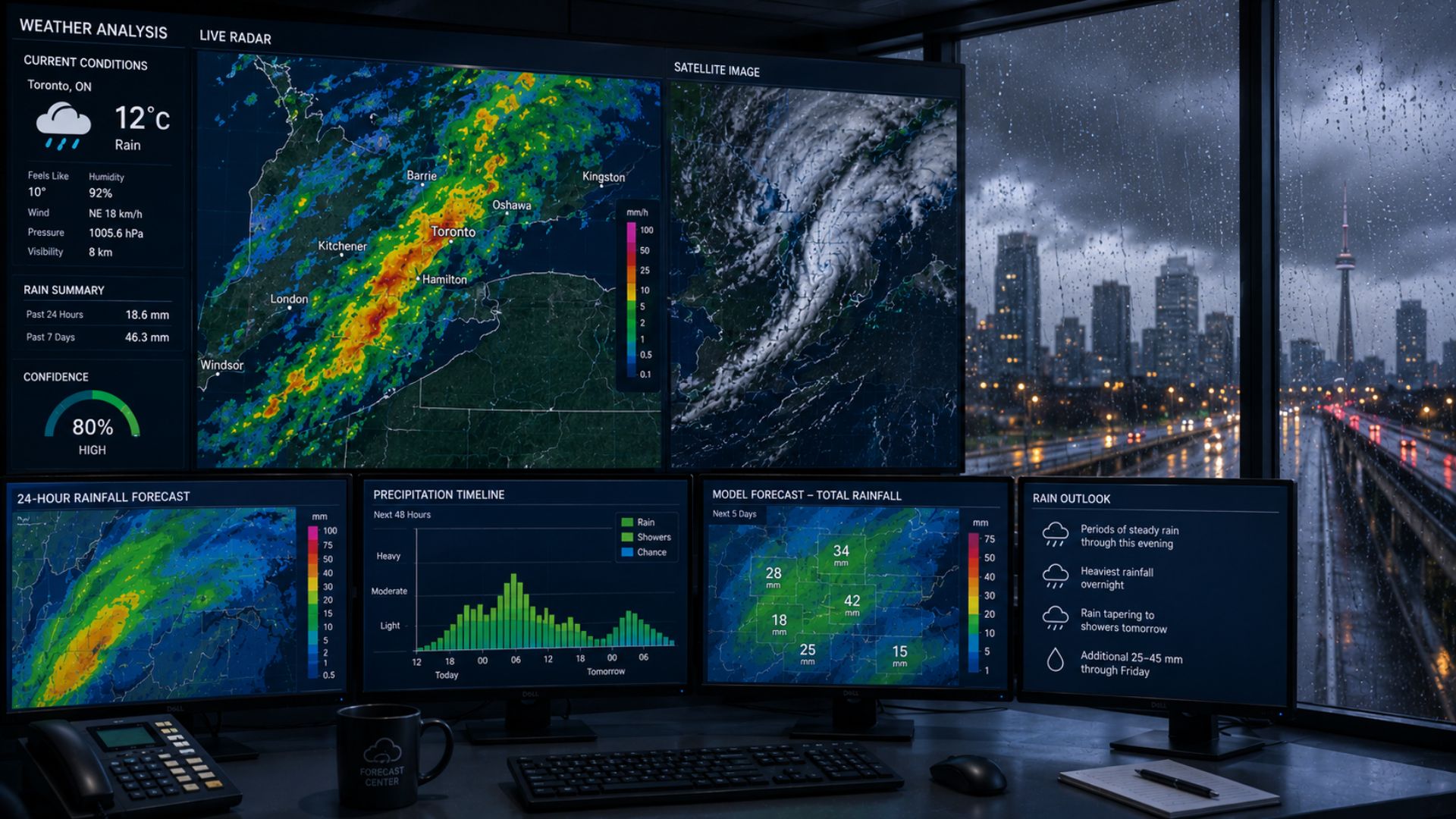

Meteorologists predict rain by studying moisture, temperature, air pressure, wind, and the movement of weather systems through the atmosphere. They combine real-world observations from weather stations, satellites, radar, and weather balloons with computer forecast models to determine where rain could develop, when it may begin, and how much could fall.
Rain forecasts may seem straightforward, but predicting exactly when rain will reach a particular location—or how much will fall—can be challenging. Meteorologists need to determine whether enough moisture is available, what will cause the air to rise, and whether atmospheric conditions will allow precipitation to reach the ground.
How Do Meteorologists Know When It Will Rain?
For rain to develop, the atmosphere needs the right combination of moisture and rising air.
Water is constantly present in the atmosphere as water vapour. When moist air rises, it expands and cools. If it cools enough to reach saturation, water vapour can condense onto tiny particles in the atmosphere, forming cloud droplets.
Cloud droplets are initially extremely small. As droplets collide and combine, they can eventually become large and heavy enough to fall from the cloud as precipitation.
Meteorologists therefore look for several ingredients when forecasting rain:
- Moisture: Enough water vapour must be present to support clouds and precipitation.
- Lift: Air must rise and cool, which can happen along weather fronts, around low-pressure systems, over terrain, or through convection.
- Atmospheric stability: The structure of the atmosphere affects how easily air can rise.
- Temperature: Temperatures throughout the atmosphere help determine whether precipitation reaches the ground as rain or another precipitation type.
Forecasters examine how these ingredients are expected to change over time to determine when and where rain is most likely.
What Tools Do Meteorologists Use to Predict Rain?
No single instrument can provide everything meteorologists need to forecast rain.
Instead, observations from multiple systems are combined with numerical weather prediction models to build a more complete picture of the atmosphere.
Weather Models
Computer weather models are among the most important tools for predicting rain before it develops.
Numerical weather prediction models use mathematical equations to simulate how the atmosphere may evolve over the coming hours and days.
Models can provide forecasts for variables such as:
- Atmospheric moisture
- Temperature
- Air pressure
- Wind speed and direction
- Cloud cover
- Precipitation
- Atmospheric instability
- Movement of weather systems
Meteorologists can use this information to estimate where precipitation could develop and how it may move.
Forecasters generally compare multiple weather models rather than relying on one prediction. They also compare newer model runs with previous ones to determine whether the forecast is becoming more consistent.
If several models repeatedly show rain developing over the same area at approximately the same time, confidence in the forecast may increase.
Weather Radar
Once precipitation develops, weather radar becomes one of the most useful tools for monitoring it.
Radar sends pulses of energy into the atmosphere and measures signals reflected back by precipitation particles.
This allows meteorologists to see where precipitation is occurring and how it is moving.
Radar imagery can help forecasters track:
- Areas of rain
- Rainfall intensity
- Movement of precipitation
- Bands of heavier precipitation
- Showers and thunderstorms
- Changes in precipitation coverage
This information becomes particularly useful for short-term forecasting.
If a large area of rain is moving toward a city, radar can help meteorologists estimate when it may arrive and how long precipitation could continue.
Radar does have limitations, however. Meteorologists still need surface observations and other atmospheric information to determine what is actually reaching the ground.
How Do Satellites Help Predict Rain?
Weather satellites allow meteorologists to observe clouds and weather systems across enormous areas.
Unlike local weather radar, satellites can monitor storms over oceans and remote areas where radar coverage may be limited or unavailable.
Satellite imagery helps meteorologists identify:
- Developing cloud systems
- Atmospheric moisture
- Movement of weather systems
- Cloud-top temperatures
- Weather fronts
- Large areas of organized precipitation
Meteorologists can monitor how cloud systems develop and compare their actual evolution with computer model forecasts.
Satellite information is particularly valuable before a weather system reaches a region.
For example, a large low-pressure system moving across the continent may be visible in satellite imagery long before its rain reaches a particular community.
How Do Weather Balloons Help Predict Rain?
Surface conditions only provide information about the lowest part of the atmosphere.
To understand whether rain could develop, meteorologists also need to know what is happening thousands of metres above the ground.
Weather balloons carry instruments called radiosondes through the atmosphere. These instruments measure temperature, humidity, pressure, wind speed, and wind direction at different altitudes.
This creates a vertical profile of the atmosphere.
Meteorologists can use this profile to determine how much moisture is available, how temperatures change with altitude, and whether atmospheric conditions support rising air and precipitation.
Weather balloon observations are also used to help initialize computer weather models, making them an important part of the broader forecasting process.
How Do Meteorologists Predict Where It Will Rain?
Meteorologists examine how moisture and weather systems are expected to move across a region.
Low-pressure systems and weather fronts are particularly important.
A cold front forms where advancing colder air meets warmer air. The denser cold air can force warm, moist air upward, potentially producing clouds, showers, or thunderstorms.
A warm front occurs when warmer air moves over cooler air. This can produce widespread cloud cover and longer periods of precipitation.
Low-pressure systems can also create large areas of rising air and organized precipitation.
Meteorologists use weather models to forecast how these systems will move. Satellite imagery, radar, weather stations, and other observations are then used to track what is actually happening.
How Do Meteorologists Predict When Rain Will Start?
Timing is one of the most noticeable parts of a rain forecast—and one of the most difficult to get exactly right.
Meteorologists use forecast models to estimate how quickly a weather system and its precipitation will move.
As the rain approaches, radar can provide much more detailed information about its current location and movement.
Suppose radar shows a band of rain approaching a community from the west. Meteorologists can examine its speed and direction to estimate when the leading edge may arrive.
However, precipitation does not always move at a constant speed.
Rain can weaken, strengthen, develop ahead of the main system, or dissipate before reaching a location. This is why an expected arrival time may change as newer information becomes available.
How Do Meteorologists Predict How Much Rain Will Fall?
Forecasting rainfall amounts requires more than determining whether rain will occur.
Meteorologists need to estimate how much moisture a weather system contains, how efficiently it can produce precipitation, how intense the rain may become, and how long it will remain over an area.
Weather models provide forecasts of accumulated precipitation over different time periods.
Meteorologists also examine factors such as:
- Atmospheric moisture
- Expected rainfall rates
- Duration of precipitation
- Storm movement
- Repeated rain over the same location
- Terrain
- Thunderstorm development
A slow-moving weather system can sometimes produce more rainfall than a stronger but faster-moving system simply because rain continues over the same area for longer.
Local thunderstorms can make rainfall totals particularly difficult to forecast because one community may receive a downpour while another nearby receives very little rain.
What Does Probability of Precipitation Mean?
Rain forecasts often include a probability of precipitation, commonly displayed as a percentage.
This percentage represents the likelihood of measurable precipitation occurring at a particular location during the specified forecast period.
A higher probability indicates greater confidence that precipitation will occur at that location.
It does not mean that rain will necessarily fall for that percentage of the day.
For example, a 70% probability of precipitation does not mean it will rain for 70% of the day. Rain could last for a short period or continue for several hours.
The forecast period and location are therefore important when interpreting precipitation probabilities.
Why Can Rain Forecasts Change?
Rain forecasts can change because the atmosphere is constantly evolving.
Weather models begin with observations of current atmospheric conditions. Even small uncertainties in those starting conditions can lead to differences in how a weather system is predicted to develop several days later.
Forecasts can change because of differences in:
- Storm track
- Atmospheric moisture
- Wind direction
- Temperature
- Timing of weather fronts
- Storm speed
- Development of showers or thunderstorms
A relatively small shift in the track of a weather system could move the heaviest rain away from one community and toward another.
Meteorologists continually evaluate new observations and updated model guidance, which is why forecasts are revised as weather systems approach.
Why Is Predicting Rainfall Amounts Difficult?
Rain does not always fall evenly across a region.
Large, organized weather systems can produce widespread rain, but smaller showers and thunderstorms may produce extremely localized rainfall.
Terrain can also influence precipitation.
When moist air encounters higher terrain, it can be forced upward. As the air rises and cools, clouds and precipitation may become more likely on one side of the terrain while areas farther downwind receive less.
The speed of a weather system matters as well.
If rain repeatedly develops or moves over the same area—a process sometimes described as training—rainfall totals can become much higher than originally expected.
These local differences are one reason rainfall forecasts are often expressed as a range rather than an exact amount.
How Far in Advance Can Meteorologists Predict Rain?
Meteorologists can often identify the potential for rain several days in advance.
At longer ranges, forecasts generally provide a broader indication of whether a weather system could affect a region.
As the event gets closer, forecasts can become more detailed.
Meteorologists may gain greater confidence in:
- When rain will begin
- When rain will end
- Which areas are most likely to receive rain
- Expected rainfall amounts
- Whether thunderstorms could develop
- Whether heavy rainfall is possible
Short-term radar and surface observations become especially valuable once precipitation is already developing nearby.
Even then, the exact timing and intensity of individual showers can remain difficult to predict.
How Accurate Are Rain Forecasts?
The accuracy of a rain forecast depends partly on the type of weather producing the precipitation and how far into the future the forecast extends.
A large weather system producing widespread rain may be easier to forecast geographically than isolated showers that develop over small areas.
Forecast confidence also generally increases as an event approaches because meteorologists have access to newer observations and updated model guidance.
However, no forecast can perfectly predict every drop of rain.
The atmosphere is complex, and relatively small changes can influence exactly where precipitation develops and how much falls.
How Are Rainfall Warnings Issued in Canada?
Environment and Climate Change Canada issues weather alerts when significant rainfall or other hazardous weather conditions are expected.
Meteorologists consider factors such as expected rainfall amounts, duration, intensity, existing conditions, and potential impacts when evaluating a rainfall event.
Rainfall warnings are especially important when heavy or prolonged rain could increase the risk of localized flooding, rapidly rising water, difficult travel, or other hazards.
Because conditions can change as a weather system develops, warnings and forecasts may be updated as new information becomes available.
During potentially hazardous weather, Canadians should follow current forecasts and official weather alerts from Environment and Climate Change Canada.
The Bottom Line
Meteorologists predict rain by combining observations of the atmosphere with computer weather models.
Weather satellites reveal large-scale cloud and moisture patterns, weather balloons measure conditions above the surface, radar tracks precipitation as it develops, and surface weather stations show what is actually happening on the ground.
Meteorologists bring all of this information together to determine whether the atmosphere contains enough moisture, where air is likely to rise, how weather systems will move, and how much precipitation they could produce.